RIBEIRA DE MUGE, A NATIONAL TREASURE
Distance: 11.3 km
Duration: 4h
Degree of Difficulty: Easy
Location: Marianos - Casal da Tira
Trail departure point: Casal da Tira in the square next to the brook
Coordinates: 39.179478, -8.471476
This trail runs along the Muge Brook, one of the tributaries of the Tagus River, and also takes you through the surrounding fields with well-preserved cork oak groves and a fertile meadow that is good for farming.
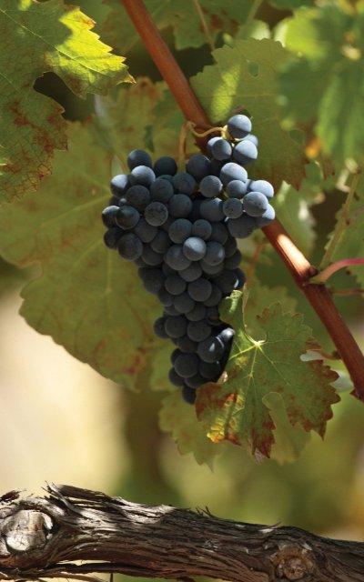
The starting point in the square near the Casal da Tira Bridge offers easy parking and has restaurants on hand. The trail continues along the western side, along the town’s main street. It is a typical rural town with single-storey homes, adjacent agricultural plots, vegetable gardens and orchards. There are also small vineyards for personal consumption dotting the landscape. Beyond the houses and the asphalt section of the road, the remainder of the trail takes you along dirt roads. After the first kilometre, cork oaks begin to dominate the landscape.
At the start of the dirt road, do not turn left; rather, go straight ahead for some 600 metres. At the sign that says "ponto de água” (water point) turn left. After this initial flat part, the climb to the highest point begins. This entire section runs through a cork oak grove awash in the sound of forest birds. The cork oak forests of the Iberian Peninsula are the ideal habitat, offering food and shelter to many species of animals; more than
160 species of birds have been noted in this ecosystem, not to mention 37 species of mammals and 24 species of reptiles and amphibians .
Half-way up, on the right side, there is a small reservoir where some animals go to drink water; you can easily spot mammals such as foxes or wild boars (Sus scrofa).
Once you reach the fork in the road, follow the path on the right. Some 500 metres farther on, as you near the peak, the path joins another road. Go left here. This part of the route goes through two continuous patches of forest. Various paths branch off from here, but always follow the one on the right, keeping a dispersed cork oak grove on your left and a denser pine forest on your right-hand side. In this area you may come across several strawberry trees (Arbutus unedo). After about 900 metres turn right and continue uphill through the middle of the pine forest. Some 150 metres ahead, turn right once again and keep following the main road along the ridges, now with the pine forest on your right and an area of heath on your left.
On a clear day, you can see Almeirim, Santarém and the Aire Mountain from this higher part. This is also a good location to see large eagles, such as the buzzard (Buteo buteo) or the short-toed snake eagle (Circaetus gallicus), which, as the name suggests, feeds mostly on reptiles, especially snakes, but also lizards. Sometimes it will hunt small mammals and on rare occasions birds or insects.
Some 1,200 metres ahead, turn right and cross the pine forest. From here on, the trail begins to descend until it reaches the Muge Brook and the dispersed cork oak grove. About 100 metres ahead,
when you reach a fork in the road, take the path on the right and, after another 100 metres, turn left. Keep going for about 150 metres and turn left once again. Another 100 metres ahead, once you reach the fork in the road, turn right once again and keep going straight ahead for about 400 metres until you reach the Fazendas de Almeirim picnic park. Here you will find a spring that feeds the Vale d’Água fountain and several tables where you can stop for a rest. There are many birds here, such as the great tit (Parus major). While standing next 10 ALMEIRIM • RIBATEJO to the fountain, on your left side, there is a small lake and in front of it the vegetation of the brook. Follow a narrow path and cross a small footbridge to the opposite bank. Turn right here. Now that you are returning to your starting point, the path will always be level along the Muge Brook and its dense gallery forest.
Continue going straight ahead along the Muge Brook with various fields of crops, orchards and vineyards on your left. This meadow is very fertile and good for farming due to being relatively flat, since this means that during the flood season the river overflows and floods the adjacent fields. You will cross an asphalt road and see several tracks on your left, but keep going straight on. About two kilometres ahead, the road seems to
end and turn to the left. At this point, keep going straight ahead along a path surrounded by dense vegetation, keeping the waterline to your right. Some 200 metres ahead, you will once again come to a dirt road. Keep going straight ahead; there is a fenced-off field on your left where you will sometimes see animals. About 700 metres farther on, you will come to an asphalt road. Here, turn right and cross the bridge, thus returning you to your departure point.


